Best Handheld Marine GPS Chartplotters for Every Angler and Boater
Looking for a reliable handheld marine GPS chartplotter? This guide highlights five top Garmin models that are well-suited for boating, fishing, or coastal navigation. Each option is evaluated for ruggedness, display clarity, offline mapping, and floatability to help you pick the right device for your needs. Best for casual coastal trips, serious anglers, or expedition-style boating, these units balance durability with practical features.
| Product | ||
|---|---|---|
| Garmin GPSMAP 79sc | Coastal anglers and saltwater boats | Floating, BlueChart g3, wide satellite support |
| Garmin GPSMAP 86Sci | All-weather sailors needing data fusion | Floating, InReach, data streaming |
| Garmin GPSMAP 79s | Rugged roamers with global charts | Global basemap, high memory, floatable |
| Garmin GPSMAP 78 2.6-Inch | Compact handheld for boats and watersports | BlueChart g2, IPX7 waterproof |
| Garmin GPSMAP 78S | Worldwide chartplotting on the move | 2.6″ display, shaded relief basemap |
Garmin GPSMAP 79sc, Floating Marine GPS

The Garmin GPSMAP 79sc is a rugged handheld with a high-resolution color display and scratch-resistant glass. It floats and is IPX6 water resistant at the unit level. It supports multiple satellite constellations for global tracking and includes BlueChart g3 coastal maps. This model is best for saltwater anglers and coastal navigators who value reliability, memory expansion for waypoints and routes, and a built-in compass.
- Best for: Coastal anglers, saltwater boaters seeking a buoyant, durable device.
- Why selected: Floating design, BlueChart g3 coverage, broad satellite support, and generous storage for waypoints and routes.
- Caution: The unit-level IPX6 rating means it is water resistant but not fully waterproof in all submersion scenarios.
Garmin GPSMAP 86Sci, Floating Handheld With InReach

The GPSMAP 86Sci is designed for serious sailors. It floats, features a 3″ sunlight-visible display, and supports streaming boat data from compatible chartplotters. Preloaded BlueChart G3 coastal charts provide robust coverage. It stands out for the ability to consolidate marine system information from multiple instruments via data streaming, which can be valuable for integrated navigation setups.
- Best for: Sailors who value data integration and InReach satellite capabilities for remote operations.
- Why selected: Floating, reliable chart data, and seamless data streaming from compatible equipment.
- Caution: The feature-rich interface may require a learning curve for new users.
Garmin GPSMAP 79s, Worldwide Chartplotter

The GPSMAP 79s offers rugged portability with a floating, high-resolution display and expanded memory for thousands of waypoints, routes, and activities. It supports multiple satellite constellations for global tracking and includes rugged, water-resistant construction. It is a solid choice for boaters who need a reliable, all-terrain handheld with ample memory for long trips.
- Best for: Boaters seeking a durable handheld with strong global coverage.
- Why selected: Floating capability, memory capacity, and versatile satellite support.
- Caution: IPX6 rating indicates water resistance but not full submersion protection in all conditions.
Garmin GPSMAP 78 2.6-Inch Marine GPS
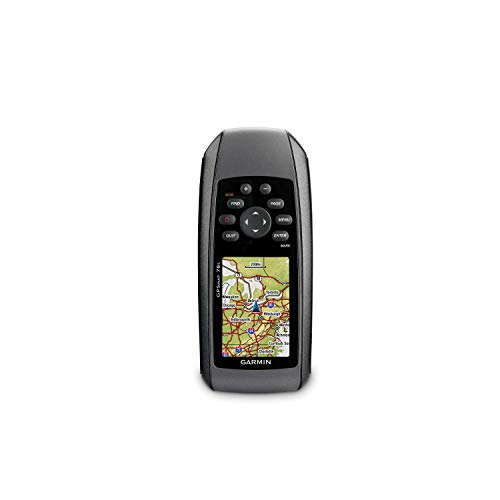
This compact 2.6-inch option is ideal for lightweight gear on boats or during watersports. It ships with a 1.7 GB memory and a 160 x 240 display resolution. It includes built-in BlueChart g2 U.S./Bahamas charts that show shorelines, depth contours, navaids, and marinas. The small form factor makes it easy to carry on day trips while still providing essential marine mapping.
- Best for: Light-duty, portable navigation when space is limited.
- Why selected: Small footprint with capable BlueChart g2 mapping for coastal navigation.
- Caution: Limited internal memory compared to larger models; consider expansion if planning detailed trips.
Garmin GPS 73, 2.6 Inches

The GPS 73 provides sailing-focused features, including virtual starting line, countdown timers, speed history, and tack assist. It offers long battery life (18+ hours on two AA batteries) and marine alarms such as MOB and off-course alerts. This model suits sailors who need specialized sailing tools in a compact handheld.
- Best for: Sailors focusing on race-day features and long battery life.
- Why selected: SailAssist features and extended battery performance.
- Caution: Fewer advanced chartplotting options compared to larger models; rely on basic marine charts.
Garmin GPSMAP 010-02256-00 eTrex 22x

The eTrex 22x delivers a reliable 2.2″ sunlight-readable display and Topo Active maps with routable roads and trails. It is designed for hiking and light outdoor use, but its rugged build and preloaded topo maps make it a solid choice for mixed-use outdoor enthusiasts who also need basic marine navigation planning.
- Best for: Multi-purpose outdoor enthusiasts who occasionally navigate near water.
- Why selected: Readable display, topo maps, and durability for varied environments.
- Caution: Primarily an outdoor navigator; marine depth and tidal data are limited compared to dedicated chartplotters.
Garmin GPSMAP 78S Marine Navigator

The GPSMAP 78S combines a 2.6-inch display with a worldwide shaded relief basemap and microSD expandability. It features a 3-axis compass and barometric altimeter for improved navigation data. Intended for anglers and boaters who need a compact, globally capable plotter with map expansion options.
- Best for: Boaters seeking a compact, expandable solution with an advanced navigation toolkit.
- Why selected: MicroSD mapping option and integrated compass/altimeter for precise navigation.
- Caution: Smaller screen size may limit readability in bright sunlight compared to larger units.
Buying Guide: What To Consider When Choosing A Handheld Marine GPS Chartplotter
Display and readability matter for quick interpretation while underway. Look for sunlight-visible screens and legible fonts. Battery life is crucial for long trips; prioritize models rated for extended hours and consider battery type (AA vs built-in). Waterproofing and floating capability improve safety on rough seas. Mapping matters: BlueChart, Navionics, or topo maps impact how you view depths, coastlines, and routes. Satellite support and compatibility with other instruments affect data fusion and tracking reliability. Finally, consider size, weight, and ease of use with gloves on deck.
What kind of user should buy a floating handheld?
Floating devices provide extra safety if dropped in water and are generally preferred by anglers and open-water navigators who may encounter rough conditions.
Should I choose a model with InReach or satellite connectivity?
InReach or satellite-capable models offer emergency messaging and location sharing, valuable for offshore trips or remote areas without cellular coverage.
Is more memory always better?
More memory means more waypoints, routes, and maps, which is useful for long trips, multiple basemaps, and deep chart libraries.
What about mounting and portability?
Consider whether you need a rugged handheld for waist-level use or a compact unit that fits into a dry bag or pocket. Weight and durability influence long-term comfort during extended voyages.
How important is chart accuracy?
Accurate charts help in safe navigation, especially near shoals, shallow harbors, and coastal channels. Check the chart provider’s data coverage for your area.
What is the best choice for a beginner?
A model with intuitive controls, preloaded coastal charts, and straightforward routing is ideal for beginners, while more complex systems suit advanced navigators.
Quick comparison table
| Model | Best For | Key Benefit | Notable Limitation |
|---|---|---|---|
| GPSMAP 79sc | Coastal Anglers | BlueChart g3, Floating | IPX6 rating |
| GPSMAP 86Sci | Sailors | InReach, Data Streaming | Complex interface |
| GPSMAP 79s | Global Navigation | Large memory, Global basemap | |
| GPSMAP 78 | Compact Boating | BlueChart g2, Waterproof | |
| GPSMAP 78S | Worldwide Chartplotting | Shaded relief basemap | Smaller screen |
Frequently Asked Questions
- What is the advantage of a handheld marine GPS over a smartphone app?
Answer: Handheld devices provide ruggedness, waterproofing, long battery life, dedicated marine charts, and independent GPS when cellular coverage is absent. - Do these units float and stay readable in bright sun?
Answer: Most models listed offer floating capability and sunlight-readable displays, which improve visibility on open water. - Can I upgrade charts after purchase?
Answer: Yes, many Garmin handhelds support map upgrades or add-on chart packs to expand coverage. - Is satellite connectivity necessary for coastal trips?
Answer: Not strictly, but InReach or satellite features add safety for remote or offshore voyages. - Which model is best for a beginner?
Answer: The GPSMAP 79s or 78 series offer straightforward navigation features with proven coastal charts. - How important is chart detail for navigation near shoals?
Answer: Very important; choose a device with up-to-date BlueChart or Navionics data for precise depths and aids to navigation.