Best Handheld GPS for Boats: Reliable Navigation on the Water
Finding a dependable handheld GPS for boating means balancing water durability, satellite reception, screen readability, and map depth. The following five models from Garmin are geared toward marine use, floating design, and multi-constellation access to help you stay on course whether you’re coastal cruising or offshore exploring. The selections below summarize core specs and features to guide your choice.
| Product | Key Feature | Water/Durability | Navigation Strength |
|---|---|---|---|
| Garmin eTrex 22x | Topo Active maps, routable roads and trails | Water-resistant | Solid for general marine use, off-road prep |
| Garmin GPSMAP 79s | Worldwide basemap, rugged and floating | Floating, IPX6 | Global tracking with many waypoints |
| Garmin GPSMAP 65 | Multi-band GNSS, expanded satellites | Water-resistant | Strong in challenging locations |
| Garmin GPSMAP 86Sci | Inreach capability, bluechart coastal charts | Floating, water-resistant | Marine data integration |
| Garmin GPSMAP 79sc | BlueChart g3 coastal charts, rugged | Floating, IPX6 | Solid coastal navigation |
Garmin eTrex 22x Rugged Handheld GPS Navigator

The Garmin eTrex 22x is built for outdoor reliability with a 2.2-inch sunlight-readable color display (240 x 320 pixels). It comes preloaded with topo Active maps that include routable roads and trails, making it useful for onshore prep and marine trips. Its rugged construction offers dependable performance in wet conditions, while the clarity of the display remains readable in bright sun. This model balances portability with core navigation tools, suitable for boaters who also spend time ashore or on trails.
Garmin GPSMAP 79s Marine GPS Handheld

The GPSMAP 79s is designed for marine adventures with a rugged, floating chassis and IPX6 water resistance. It features a high-resolution color display and scratch-resistant glass. A notable advantage is the expanded memory to store up to 10,000 waypoints, 250 routes, and 300 activities, plus support for multiple satellite systems (GPS, GLONASS, Beidou, Galileo, QZSS, SBAS) for global reliability. This handheld excels for boaters who need extensive waypoint management and global reach.
Garmin GPS 73 Marine Handheld
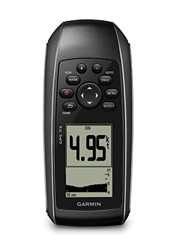
The GPS 73 offers sailing features such as a virtual starting line, countdown timers, speed history, and tack assist, helping with race prep and precise timing. It provides long battery life (18+ hours on two AA batteries) and specific marine features like MOB alerts, off-course warnings, anchor drag alerts, and robust route planning. This model suits boaters who value sailing-specific tools alongside reliable navigation for longer trips.
Garmin GPSMAP 65 Handheld with Multi-Band GNSS

The GPSMAP 65 emphasizes expanded satellite support and multi-band technology for improved accuracy in challenging environments like urban canyons or dense cover. Its 2.6-inch color display remains readable in sunlight, and it includes routable TopoActive maps along with a federal public land map for U.S. terrain. This model is well-suited for mariners who frequently navigate in complex surroundings and need dependable signal reception across continents.
Garmin GPSMAP 86Sci Floating Handheld

The GPSMAP 86Sci is a floating handheld with a 3-inch sunlight-visible display and button-based operation, designed for straightforward use on deck. It supports onboard data display from compatible chartplotters and instruments, consolidating marine information in one device. Preloaded BlueChart coastal charts provide coastal detail, while inReach satellite communication enables messaging and SOS features when offshore. This model is ideal for sailors who want integrated data sharing and resilience at sea.
Garmin GPSMAP 79sc Marine Handheld (Renewed)

The GPSMAP 79sc is a rugged, floating handheld with preloaded BlueChart g3 coastal charts and a durable build suitable for saltwater environments. It offers memory expansion to store thousands of waypoints and routes and supports multiple satellite systems for reliable world-wide tracking. While renewed, it maintains core marine navigation features that boating users rely on for steady coastal and near-shore navigation.
Buying Guide
- Water resistance and flotation: If you often drop clues in spray or rough seas, choose models explicitly designed to float and withstand water exposure (IPX ratings are a good indicator).
- Screen readability: Look for sunlight-readable displays and appropriate screen size. Marine use benefits from clear, high-contrast screens that remain readable in bright sun.
- Satellite support: Multi-band GNSS (GPS, GLONASS, Beidou, Galileo) and a wide satellite network improve accuracy, especially near shore, in canyons, or tree cover.
- Maps and data depth: Preloaded coastal charts or topo maps determine how well you can plan routes and identify hazards. Consider devices with routable maps and the ability to load additional maps.
- Battery life: For lengthy trips, longer battery life matters; some models run on dedicated batteries while others use AA cells. Assess average runtime in marine conditions.
- Integration and data sharing: Some models offer data sharing, inReach satellite messaging, or compatibility with chartplotters. Determine if you need on-deck data consolidation or offshore SOS features.
- Portability and durability: A compact design aids mobility around deck space, while rugged construction helps withstand salt spray and vibrations.
In selecting a handheld GPS for boating, prioritize models that balance flotation capability, screen clarity, and robust satellite access. For sailors needing sailing-specific functions, the GPS 73 presents dedicated timing and tack tools, while the GPSMAP 86Sci adds inReach connectivity for remote messaging. For comprehensive coastal navigation with data sharing, consider the GPSMAP 86Sci or GPSMAP 79sc, which pair chart detail with rugged, water-friendly builds. The eTrex 22x and GPSMAP 79s remain versatile choices for general navigation and waypoint management when mixed-terrain use is common.